
Mount Whitney
Horseshoe Meadows to Onion Valley
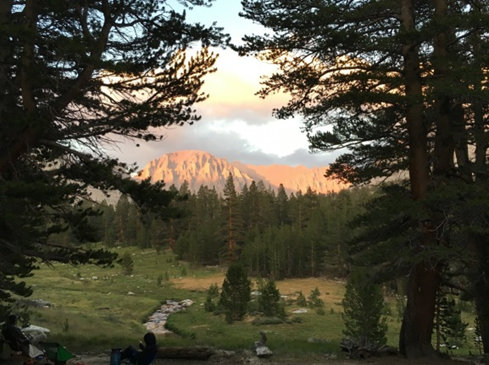
At 14,505 feet, Mt. Whitney is the highest peak in the Lower 48, but the real beauty of this itinerary lies in the 70-mile trail experience. The high-elevation approach provides essential acclimation before summitting, and the route carries you over four stunning alpine passes and through scenic lake basins perfect for camping layovers.
Duration: 9 nights
Distance: 70 miles
Best Time: July–Sept.
Submitted by
GSSD Backpacking Trainers
Created
December 2019
Starting Trailhead: Cottonwood Lakes
Ending Trailhead: Kearsage Pass
Day 1
Drive to Horseshoe Meadows and set-up camp at the Cottonwood Lakes Trailhead Campground. (Don’t get mixed up with the Cottonwood Pass Trailhead Campground.) Relax and acclimate to the high altitude.
Day 2
Head north on Cottonwood Lakes Trail to the New Army Pass Trail junction. (3.5 miles)
Turn left onto New Army Pass Trail and set-up camp at Long Lake. (2.5 miles)
Day 3
Continue west on New Army Pass Trail to the Upper Rock Creek Trail junction. (4.75 miles)
Turn right onto Upper Rock Creek Trail and head north to set-up camp at Soldier Lake. (.75 miles)
Day 4
Head west on Rock Creek Lake Trail to the Pacific Crest Trail junction. (3.75 miles)
Turn right onto the Pacific Crest Trail and head north to set-up camp at Guyot Creek. (1.75 miles)
Day 5
Continue north on the Pacific Crest Trail to the John Muir Trail junction. (5.25 miles)
Turn right onto the John Muir Trail and head east to Guitar Lake. (3.75 miles)
Consider camping at the small tarns above Guitar Lake for more solitude and a shorter summit approach.
Day 6
Summit day. Day hike to Mt. Whitney heading east on the John Muir Trail. Head back to Guitar Lake. (10 miles)
Day 7
Head west on the John Muir Trail to Crabtree Meadows for a resupply. (2.75 miles)
Continue west, then north on the John Muir Trail to Wright Creek; set-up camp. (5 miles)
Day 8
Continue north on the John Muir Trail and set-up camp in the lake basin south of Forester Pass. (7.5 miles)
Day 9
Continue north on the John Muir Trail and set-up camp at Vidette Meadow, along Bubbs Creek. (8.5 miles)
Day 10
Continue north on the John Muir Trail to the Kearsage Pass Trail junction. (2.5 miles)
Turn right and head east on the Kearsage Pass Trail through to Onion Valley Campground. (7.25 miles)
Head to Lone Pine for showers (Mt. Whitney Portal Hotel, Hostel & Store), lunch, and souvenirs at the Eastern Sierra Interagency Visitor Center. Drive home.
Itinerary Options
For a 50-mile trip, exit via Whitney Portal. You’ll need a Whitney exit permit, which is limited in number. Be sure to request this exit permit at the same time you reserve your entry permit.
Key Risks
Critters: You’re in bear country. There are strict rules on storing scented items including the need for bear-proof containers. Know before you go and follow all instructions.
Altitude: Monitor participants for any adverse reactions.
Weather: There is the potential for exposure to extreme weather. New Army Pass can keep a stubborn snow cornice well into midsummer.
Logistics
All visitors in the Whitney Zone are required to pack out their solid human waste. Bring WAG bags.
Permits Needed
Inyo National Forest Wilderness Permit
Resources
Tom Harrison’s Mt. Whitney High Country Map
Inyo National Forest: Cottonwood Lakes Trail
Inyo National Forest: Mt. Whitney Trail
Inyo National Forest: Kearsage Pass Trail
Inyo National Forest: Cottonwood Lakes Trailhead Campground
Eastern Sierra Interagency Visitor Center
Crabtree Ranger Station (at Crabtree Meadows)
Rock Creek Pack Station (Crabtree Meadows resupply)
Resupply services can be expensive, but ask for a fee waiver since Girl Scout trips qualify as educational experiences.